The Tool
What the Tools Do
R3Survey started as a set of AutoCAD tools to handle the repetitive parts of cadastral and boundary survey drafting — entering traverse data, managing survey-specific layers, importing LandXML from field instruments, and running standard survey calculations.
It's used in-house on real jobs at Mitchell Land Surveyors, which means it gets tested against actual surveying problems rather than hypothetical ones. Development is ongoing — new features are added as practical needs arise.
Both add-ins are written in C# as compiled .NET applications — not AutoLISP routines. This gives access to the full AutoCAD and Civil 3D APIs and the performance and reliability that comes with a proper compiled add-in.
R3Survey C3D is a companion Civil 3D add-in in active development, focused on feature coding, surface modelling and DTM creation.
Core Feature
Smart Strings
A rule-based survey stringing engine that goes well beyond joining points into lines. Smart Strings evaluates field codes and point attributes, applies user-defined rules, and executes a wide range of drawing actions automatically — polylines, circles, symbols and blocks, offsets, dynamic blocks, conditional layer assignment, text labels and more. Works in both AutoCAD and Civil 3D using the same plain-text configuration files. In production use at Mitchell Land Surveyors, Smart Strings has significantly reduced drafting time and errors on every survey job.
Other Features
-
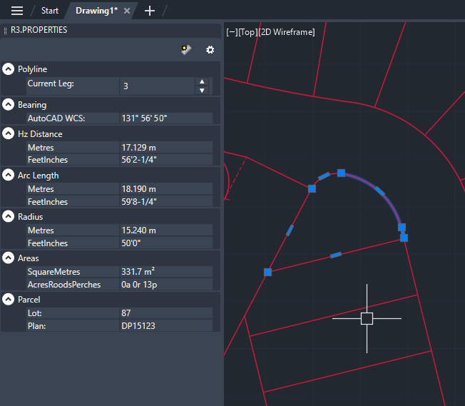
Traverse Entry — efficient entry of bearings and distances including arcs, with support for metres, feet & inches, links and more
-
LandXML / ePlan — import and export survey plans in LandXML format; export in the NSW ePlan format for digital plan lodgement with NSW Land Registry Services
-
HexagonXML (Leica Instruments) — import and export survey data in HexagonXML format; export set-out data for direct import into Leica total stations, with full control over feature naming on the instrument — meaningful identifiers in the field, not generic codes
-
Drafting Tools — commands to efficiently draft survey plans; quick text from field data, auto-generation of plan elements and hundreds of small workflow tools developed over years of production drafting
-
Survey Data Auditing — tools for reviewing and validating survey data
-
Survey Plan Tools — custom tools for cadastral plan production